

Breaking: Study Finds "50% More Rainfall During Hurricane Helene" Because of Climate Change
Breaking: Study Finds "50% More Rainfall During Hurricane Helene" Because of Climate Change
New rapid attribution studies released.

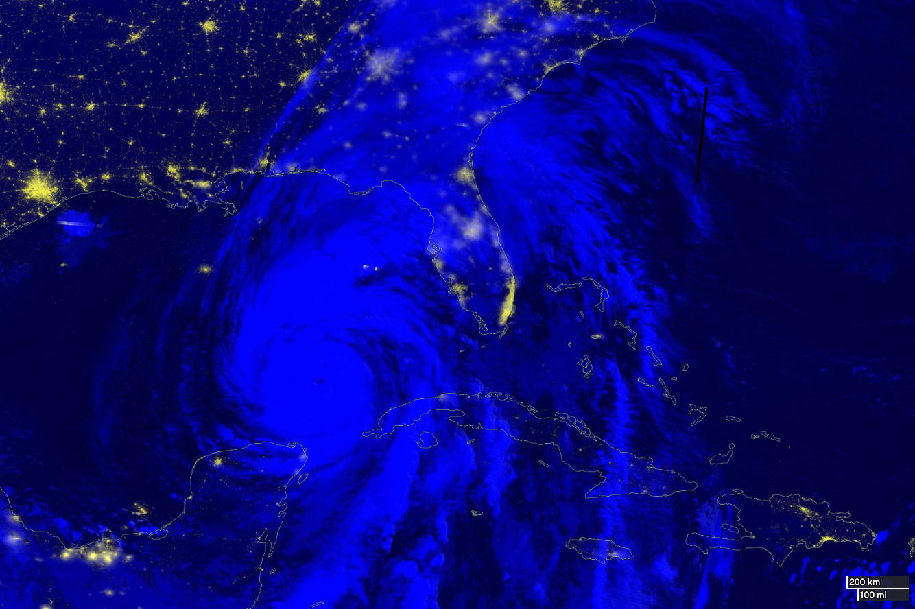
Hurricane Helene underwent rapid intensification before making landfall at the ‘Big Bend’ region of Florida. It jumped from a Category 1 hurricane to Category 4 in less than 24-hours. The storm made landfall Thursday night at approximately 11:10 PM EDT.
Today, two rapid attribution studies were released. Climate attribution studies are scientific analyses that determine the extent to which human-induced climate change influences specific weather events or patterns, such as heatwaves, floods, or hurricanes. These studies use advanced climate models and statistical methods to compare real-world data with hypothetical scenarios where human activities like greenhouse gas emissions didn't occur. The goal is to quantify the role that climate change plays in the likelihood, intensity, and duration of these extreme events, providing a clearer understanding of the connection between global warming and specific weather occurrences.
The first study found that, “Hurricanes similar to Helene have become up to 17 mm/day (up to 20%) wetter over the South East of the United States and locally up to 5 km/h (up to 7%) windier in the Florida’s Gulf coast in the present than they have been in the past. We interpret Hurricane Helene as a largely unique event for which natural climate variability played a role.”
Lawrence Berkeley National Laboratory Scientist: Mark Risser, Joshua North, and Michael Wehner found, “climate change caused over 50% more rainfall during Hurricane Helene in some parts of Georgia and the Carolinas. Furthermore, we estimate that the observed rainfall was made up to 20 times more likely in these areas because of global warming.”
In summary, both rapid studies showed a significant increase in amount of rainfall because of anthropogenic climate change.
Storm surge was significant across the Big Bend region of Florida. Unfortunately, there are no tide sensors in the area. Despite the lack of data, ground surveys can help gauge the height of the storm surge. Early estimates indicate that the surge may have reached or even exceeded 20 feet. Keep in mind, one foot of moving water has enough force to float a vehicle; 20 feet is more than enough to remove homes from their foundations or slabs. The worst of the surge was around Keaton Beach, Dark Island, Cedar Island and Fish Creek. NOAA aircraft fly these areas following hurricane to document the damage in high resolution. I created before and after imagery using Google Maps and the NOAA images.
While climate adaptation is critical, we need to be having difficult conversations about where people should be able to live. Several days before landfall, a home was listed for sale in Keaton Beach. The list price was a hair under $1 million, and the listing included the line, “don’t wait too long.”


I am happy to be part of the Iowa Writer’s Collaborative! Please subscribe to other contributors!

Thanks for the great analysis. We sure miss your expertise here in Iowa.
Great article Chris -- Thanks!